The Madaba mosaic map represents the oldest and most detailed map of the Holy Land, encompassing Palestine, Jordan, and Lower Egypt. Its origins trace back to the 6th century CE, resembling a tourist map of Palestine from the Byzantine period. Discovered in 1884 in the city of Madaba, Jordan, the map is a large mosaic floor from the Byzantine period. It was later restored and incorporated into the building of the Church of St. George. In 1897, Father Kleopas Koikylides drew and published the map, and in 1906, the first colored reproductions were published by the architects Balmacara and Gothe. The map has undergone several restoration efforts and is dated to the 6th century.
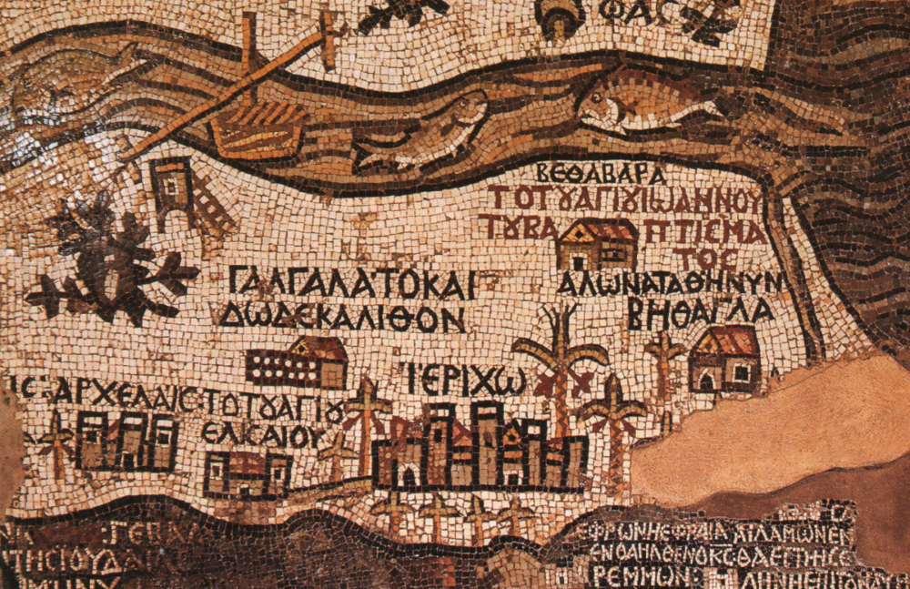
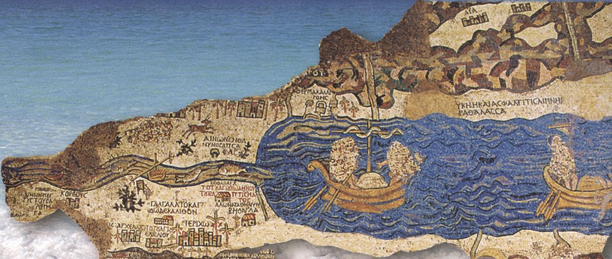
The current dimensions of the map are approximately ten and a half meters in length and five meters in width, covering an overall area of about 30 square meters. It consists of around 700,000 mosaic cubes. The map details the topography of Palestine and Lower Egypt, portraying plains and valleys in shades of white with a touch of yellow, mountains in brown, green, blue, pink, and yellow, and bodies of water in blue, brown, and black. Symbols representing cities, villages, walls, churches, other structures, humans, animals, and plants in various forms are depicted. Greek inscriptions, some in black on a light background, others in white on a dark background, and red inscriptions denoting special significance, include quotes from sacred texts.
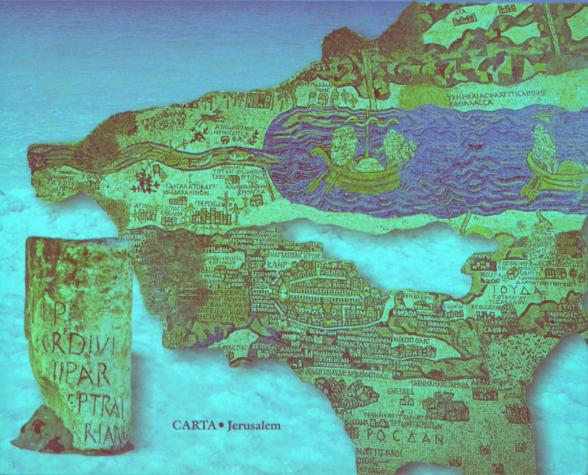
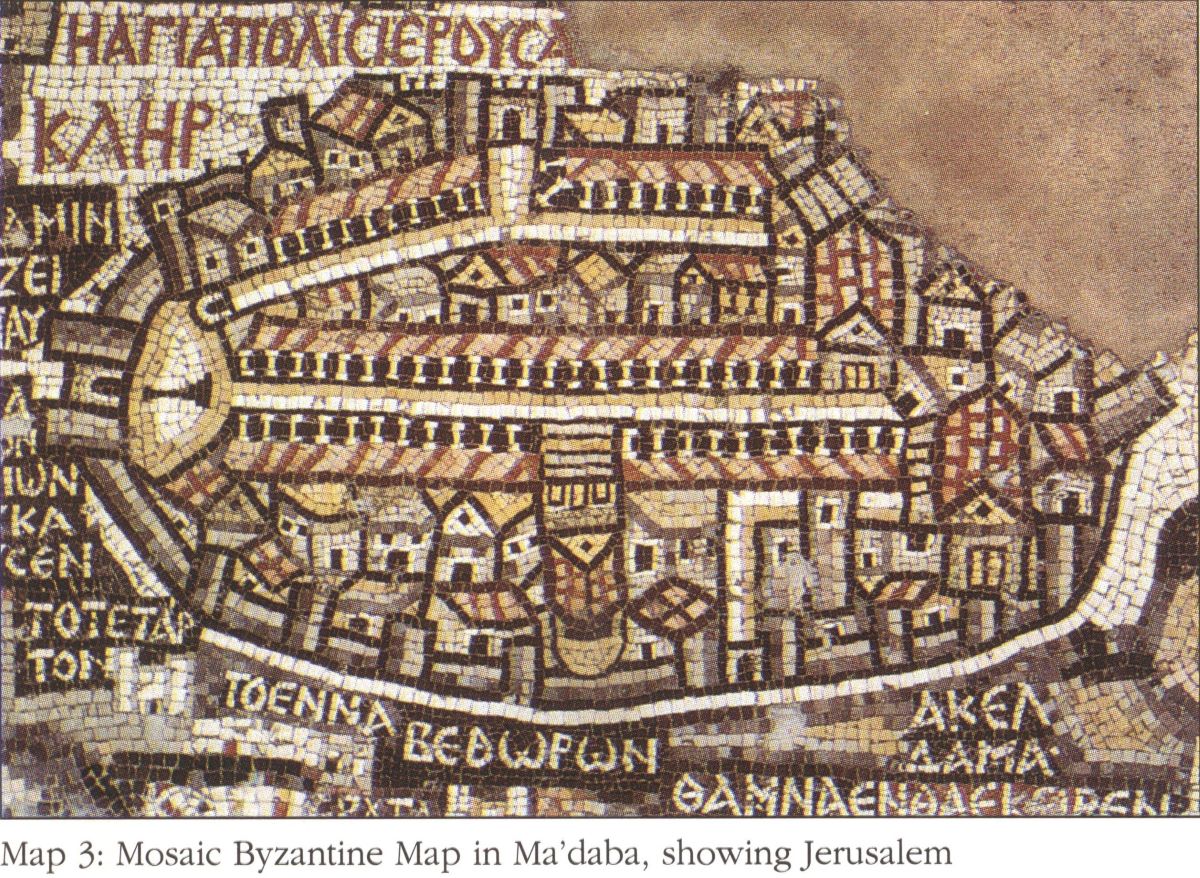
The preserved sections of the map depict the Holy Land, with Jerusalem at its center, representing the navel of the universe. The map is oriented towards the east, in alignment with the orientation of most churches. It illustrates topographical features such as the Jordan River flowing towards the Dead Sea, the eastern Jordanian mountains extending to Karak, the southern regions reaching Hebron, Beit Jibrin, the mountainous regions, the Palestinian coastal lands with Ashdod, Ashkelon, and Gaza, and the southern desert in the Negev with Be'er Sheva. Additionally, a portion of the Mediterranean Sea and the Nile Delta is included. The Madaba map holds great historical significance as a genuine geographical and topographical map, making it the oldest and most accurate map of Palestine before the advent of modern maps.